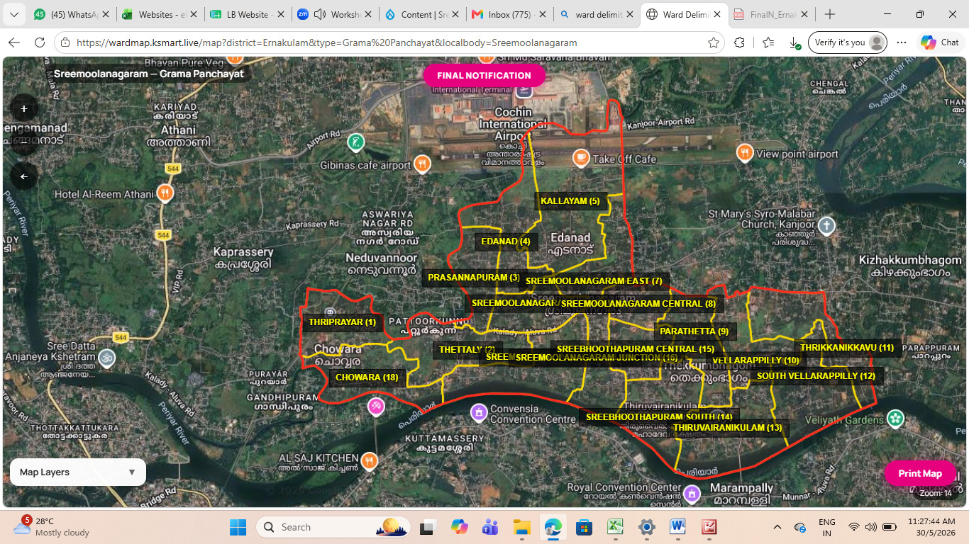

MAP
This is a digital map highlighting the ward boundaries of Sreemoolanagaram Grama Panchayat, which is located in the Aluva Taluk of Ernakulam district. This image is sourced from the live map of K-SMART, the official data collection portal of the Government of Kerala. The information provided in the image can be summarized in English as follows:
Key Information
- Location: Sreemoolanagaram Grama Panchayat
- District: Ernakulam
- Boundaries: As shown in the image, Cochin International Airport is located adjacent to the north-east boundaries of this panchayat. The Periyar River flows through the southern part.